I would comment on Josh's accepted answer, which is certainly correct, but you need 50 rep to do that and I just happened to see this on the "Hot Network Questions" sidebar. But I digress...
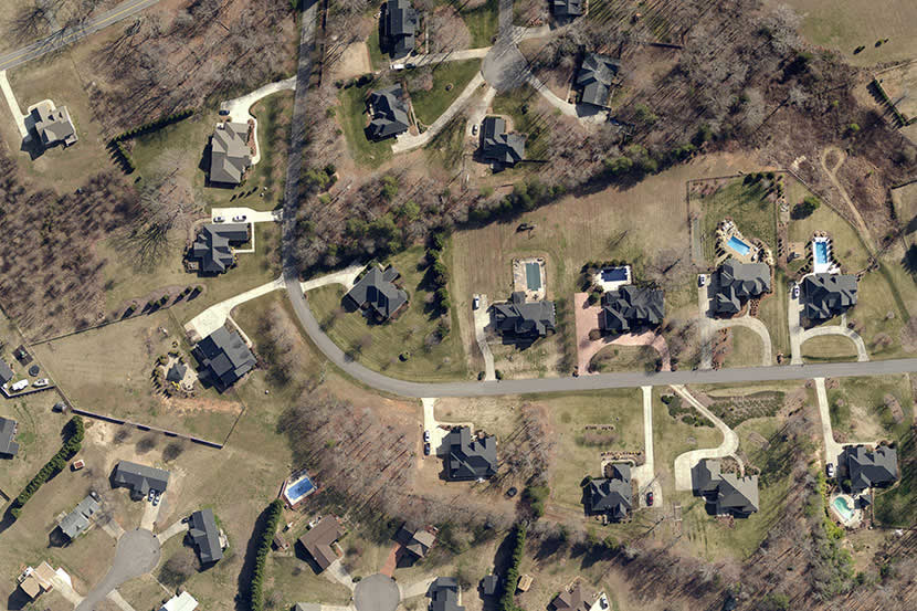
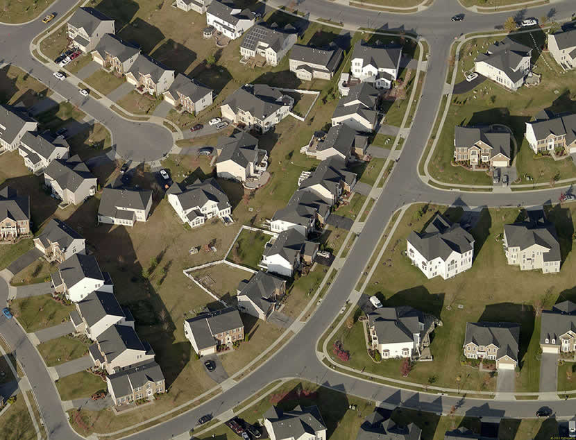
Coming from a background in geography, there's an easy example of orthogonal vs oblique projections in remote sensing data (like the aerial imagery you see on Google or Bing Maps). Note the rooflines most especially in the following images.
Orthagonal imagery is usually shot from a plane (or satellite) with a camera pointing directly out the bottom of the plane and looks directly down on the ground below. Thus, assuming the aircraft is flying level and the ground is flat, you can take Josh's statement about projector lines intersecting the plane perpendicularly and make the plane the ground and the projector source the camera.

Oblique projection imagery is captured at an angle and once properly georeferenced, can provide imagery that can be measured and is generally a bit more "natural" in appearance (in Bing Maps they call this "Bird's Eye"). Again, the projector lines (extending out from the camera) hit the plane at an oblique angle, thus it is an oblique projection.

I know this may not help you actually code a game, but hopefully the photos help give you a better sense of the math involved!
(Image sources: http://www.eagleview.com/Products/ImageSolutionsAnalytics/PictometryImagery.aspx - I don't have any affiliation with them, this page was just a good reference to pull examples from)


