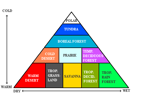
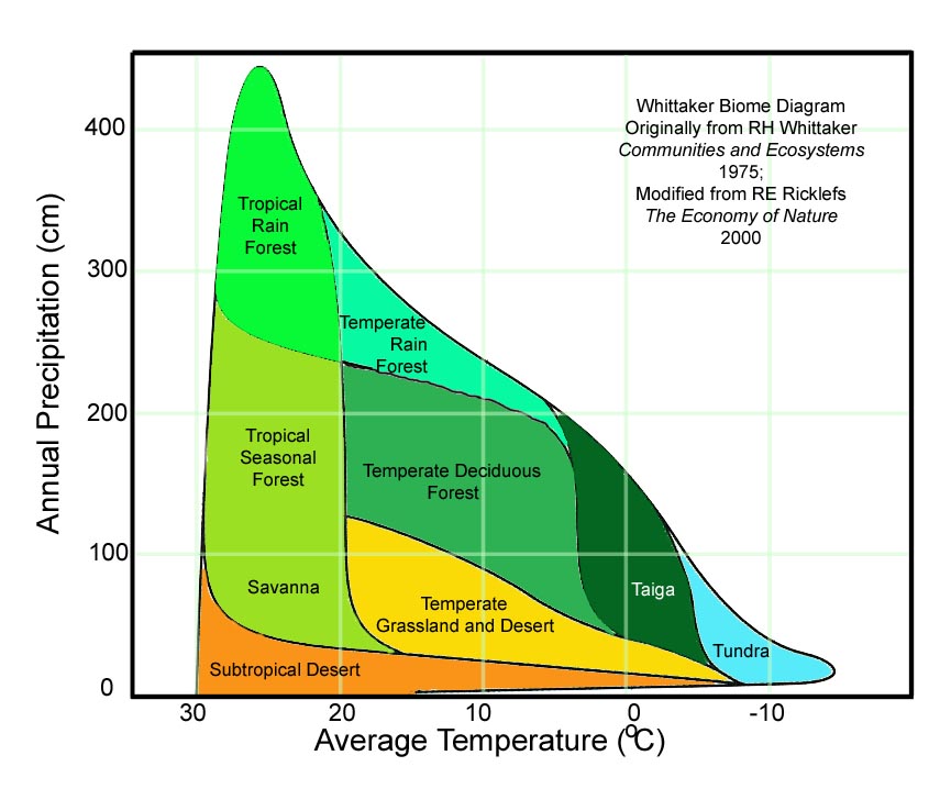
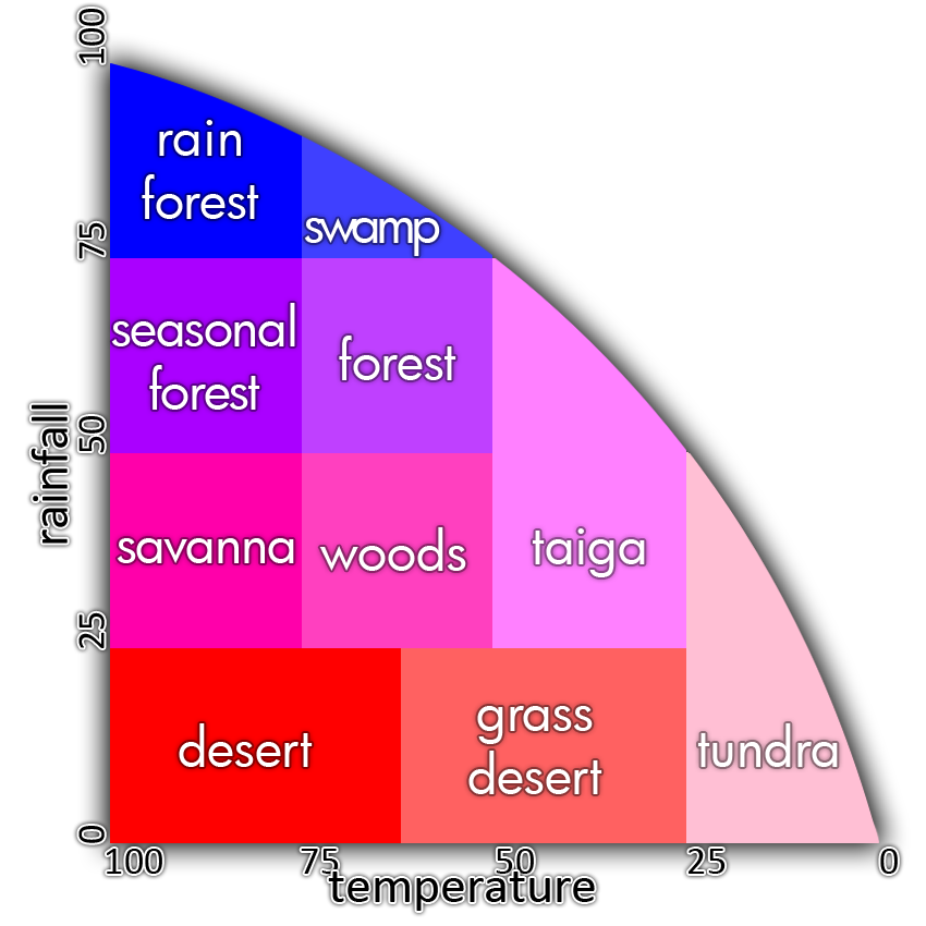
While the other answers here are really good for generating the kinds of static landscapes that would work for this specific need. There are other methods that people coming across this question might be looking for if they want to create landscapes that change over time or appear much more realistic you can follow this technique.
Unlike the other answers you begin this with an entirely empty map. Start with what you would consider to be sea level. Use Perlin Noise to add very slight variation, if you have 256 possible elevations, don't vary more than 3-5 in either direction. This builds the first few billion years of your landscape without having to actually run a simulation for that long.
Plate Tectonics
Split the map along straight or curved lines to create plates, the more detailed the shapes of the plates the more interesting your landscape with be. Keep them large. Give each plate a direction, speed. Over a given timeframe move the plates in step-wise fashion around the map, dragging all tiles above them with them.
When two plates cross, make a choice of which will go over and which will go under, this choice can be random. Tiles on plates designated under are instantly reduced in height by 5 steps. Once a plate has been designated over or under, all future interactions with plates will follow these rules:
- Where a designated plate crosses an undesignated plate, the undesignated plate becomes the opposite type. (So UD plates becomes under when crossing an over.)
- Where an over plate sits over an under plate, all those tiles move up 0-1 elevation steps, and the tiles follow the path of the over plate.
- Where an over plate crosses an over plate, all those tiles move up 1-2 steps, and the tiles in the cross over region no-longer drift.
- Where an under plate crosses an under plate, any tiles in the area with elevation greater than the 66% mark for both plates in the cross over region move up 1-3 steps (as if by volcanic activity, this will produce islands over enough time) and tiles in this area stop drifting.
All plates that cross slow by 20% of their current speed each step. For added realism, add a random -10% to 10% change in direction of movement each step.
After performing the desired number of steps. Probably 5-10 are plenty. Any tiles where no plates are resident, should be dropped to the lowest existing level.
Large or Small?
This map can be used as is, or be expanded to create a much larger map by breaking it into 4X4 tile(cell) chunks and expanding those sections based on their individual elevations. Treat each cell's elevation as a point, and create a smooth gradation in the larger map between those points. So, if the larger map is 40X40 instead of 4X4, and point (0,0) was 10 and point (0,1) was 1, the tiles on the larger map between them would be 10,9,8,7,6,5,4,3,2,1 in height. Further Perlin Noise can be added to de-smooth the slopes. Over all this scaling technique is similar to the Diamond Square algorithm.
Water
To simulate rivers and lakes, oceans and water tables. I prefer to use cellular automata.
Heights become floats or expanded int ranges to allow for finer grained tracking. Water cells have saturation values, say in the range of 1-256. The maps should start evenly. You'll need to play with the numbers for your individual map sizes, however generally you will follow rules something like this:
- If a neighbor cell is more saturated, increase saturation and gain height.
- If a neighbor cell is less saturated, decrease saturation and lose height.
Make this check for every neighboring cell. Run through a sufficient number of steps. If you want, you can add temperature to this simulation by changing the amount of lost/gained saturation by that temperature. You also can change it based on elevation. Natural lakes and rivers should form. Some will fall into the ocean. (The ocean won't probably fill by any metric, but you'll designate anything under sea-level to be water filled at the end anyway.)
You can keep the temperature and saturation data to use, like in the other answers, to create biomes. They should be MUCH more accurate and interesting. With snowy biomes at the poles and hot ones in the middle (if you uses a smooth graduated list of temperatures.)
You can also simulate wind, and therefore temperature changes based on the elevations. You can step back and forth between running the temperature simulation and the water simulation if you want. However I haven't built anything using temperature changes so I won't comment on how to do that.
Evolving Landscapes
If you keep the simulations for land, water, and heat around and dramatically reduce their effects and also stop the plates from moving, you can continue to change all of these metrics over time. I wouldn't run the calculations very often, but you can get a world map that responds to changes this way.
Conclusion
While these kinds of techniques are way more involved, they produce a lot more realistic and evolving effects. Take it for what it is worth?


